Simmerin’ Strip : Neighbors Fear Land Rush as L.B. Rezones Abandoned Rail Line
- Share via
LONG BEACH — He doesn’t know who makes such decisions, but 8-year-old Ricardo Ruan likes the idea that his small part of an unused rail line might become greener.
“A park. I would like it to be a park. There is a park, but it is about a mile away. We play here,” said Ricardo, who was sprawled with his friend Raul Quintero, 5, at the edge of the old Pacific Electric trolley right of way just south of Willow Street.
The dusty and littered strip, about 100 feet wide, separates two of the city’s poorest neighborhoods and serves as the boys’ backyard. On a recent hot midday, they pushed toy trucks across a cardboard sheet, crashing them into chunks of cement. Red ants crawled on their denim pant legs.
Ricardo told Raul in Spanish that someone might make their dirt yard a park. “Raul says, ‘All right!’ ” said Ricardo.
Vacant Strip Cuts Across Heart of City
At the southern end of the four-mile right of way, however, owners of fashionable homes near the Colorado Lagoon can’t understand why the city must do anything with their part of the vacant strip that cuts diagonally across the heart of the city.
In their part of town, the right of way used until 1950 by Red Cars bound for Newport Beach is grassy and without much litter. Joggers run there. People walk their dogs. College students have spread white sand and put up a volleyball net next to an old ticket station that now serves as a fraternity house.
“It’s nice now. Why can’t they leave it alone?” said teacher Linda Sundal, spokeswoman for the Bridgeport condominium homeowners group on 4th Street.
City planners say that will be an option of the City Council this summer, at least for the southern one-fourth of the line that is city-owned. But strong development pressures are building for the part of the strip north from 10th Street to the junction of Willow Street and Long Beach Boulevard.
That northernmost three miles is owned by the Southern Pacific Transportation Co., which seems intent on selling it, said city Environmental Officer Gerry Felgemaker.
Full Study of Development Ordered
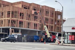
And when a developer who had bought a piece of railroad land proposed construction of a 62-unit apartment house at 11th Street last year, the Planning Commission, after approving 48 units, ordered a full study of future right-of-way development, he said.
As a result, the city has begun a rezoning process meant to match new building with adjacent neighborhoods. The entire strip has long been zoned for low-density housing, although much of its northern half is bordered by industry and part of a small shopping center has been built on it at Anaheim Street.
Planners have already hosted three community meetings in the Wilson High School area, seeking advice from nearby residents. At least three more such meetings are planned for the northern part of the strip.
By early summer, a rezoning proposal that divides the right of way into six or seven neighborhood subsections should go to the Planning Commission and then to the City Council for approval, Felgemaker said.
History, however, indicates that things may not go smoothly. A similar rezoning effort for the southern, city-owned portion was abandoned in 1983 in the face of homeowner protest. And, a decade earlier, residents protested a plan to use the strip between 4th and 7th streets as part of a cross-town freeway.
Councilwoman Jan Hall, in whose 3rd District the publicly owned portion lies, led the opposition to the freeway and was involved in the 1983 debate. She says the strip remains unsightly and should be cleaned up. And city policy requires selling unused public lands and returning them to the tax rolls, she said.
But, Hall said, “maintaining the quality of life in the neighborhoods is equally important. . . . And I’m not sure we’re going to come up with a better solution than we did last time.”
Hall says only a greenbelt has received much support from residents in her district. And Felgemaker said, “I have to say that the residents’ first and strongest preference has been for some sort of passive park.”
But parks cost money to build and maintain, and Felgemaker has been telling residents that “it would be unfair to the taxpayers to put more parks where there already is an abundance.”
Need for Central-City Parks
The greatest need is not near Wilson High, which is adjacent to large Recreation Park, but in the central city. And the city has talked with Southern Pacific about buying a strip of land next to Orizaba Park north of Anaheim Street, he said.
Other neighborhoods, such as Ricardo’s and Raul’s, along Long Beach’s border with Signal Hill, also need more parks, Felgemaker said.
But with City Manager James C. Hankla forecasting the tightest municipal budget in a decade, there may be little money to purchase recreational lands beyond an already approved expansion of King Park, said 6th District Councilman Clarence Smith.
“There is a need for more parks, but I don’t know if this purchase would be feasible,” said Smith, whose district includes the northern part of the strip.
Though unused except as a freight spur for 27 years, the right of way would not come cheaply. The Los Angeles County Transportation Commission, which is building the Los Angeles-to-Long Beach light-rail line, bought 15.8 miles of Southern Pacific right of way along the same route for $25.9 million in 1984, said commission spokeswoman Erica Goebel. The commission paid $12 a square foot, or $523,000 an acre, for the section just north of Willow, she said.
Strong Interest in Strip
Richard A. Schuffenhauer, of Southern Pacific’s real estate division, said interest in the strip now being studied has been strong. At least a dozen businessmen, including several with adjacent property, have asked about buying the land, he said.
According to Felgemaker, development could range from parks and single-family homes to industrial and commercial projects. “It all depends on the surrounding area,” he said.
Construction would be limited somewhat by the unusual configuration of the strip, which runs from southeast to northwest at a 45-degree angle, bisecting neighborhoods and creating triangles in rectangular blocks.
Auto access will be a problem because the strip does not conform with existing roads. And with a width of about 100 feet, it is not large enough for extensive driveways.
A plant nursery, an apartment complex and the Anaheim Street shopping center are the only approved uses of the right of way so far, although a California Heights group recently told the City Council that the northern strip has become an unofficial dump.
Another plant nursery is proposed for the corner of 7th Street and Ximeno Avenue and a religious group wants to build a church in that area, Felgemaker said.
“We’d like to put this issue to rest,” he said. “There isn’t any protection (against unsuitable building) for the community the way it is now.”
More to Read
Sign up for Essential California
The most important California stories and recommendations in your inbox every morning.
You may occasionally receive promotional content from the Los Angeles Times.


