Scrambling Through Hells Gate
- Share via
Grand views of the central part of the national park are a hiker’s reward for a trail-less scramble to the top of Death Valley Buttes, three distinct hills at the base of the Grapevine Mountains. The panorama includes the valley floor, the Funeral and Panamint ranges.
Death Valley Buttes are actually part and parcel of the Grapevine Mountains. Erosion of the range is leaving much rock debris at the base of the mountains; this alluvium buried the lower ridges, leaving isolated high points--in particular, the Death Valley Buttes.
The route to the buttes begins at Hells Gate, named, as the story goes, in 1905 by a mule teamster who was struck by the contrast between the relative cool of Boundary Canyon and the hotter area near the buttes. His animals would act startled and shake their heads at the sudden searing heat. “They thought they had stuck their noses through the gates of hell,” the teamster is reported to have exclaimed.
The cross-country route to the buttes is easy enough. More difficult is the narrow, rocky ridge that must be traversed. That’s best left to experienced hikers.
Directions to trail head: From the Furnace Creek Visitor Center, head north on California 190 for 11 miles. Veer right toward Beatty on the Daylight Pass cutoff and travel northeast 10 miles to Hells Gate, where you’ll find a large parking area and picnic tables.
The hike: Walk southwest toward the buttes across rocky terrain dotted with creosote and beaver tail cactus. Look for the remains of the telephone line that crossed this land, connecting Rhyolite to civilization.
After a half a mile, you leave behind this relatively gentle alluvial fan and strike southward toward the ridge of the easternmost butte. Follow the rock crest westward, aided by a sketchy trail, to the top of the second butte, a 2,725-foot summit. Admire the barren Grapevine Mountains nearby, and the equally austere Funeral Mountains extending southeast.
You can return the way you came, or continue to the next and highest butte. If you press on (recommended only for the most experienced of hikers) you’ll descend the steep ridgeline west to a saddle, then ascend the narrow ridge a half a mile to Peak 3,017. Enjoy the view across the shimmering valley floor to the Panamint Mountains.
(BEGIN TEXT OF INFOBOX / INFOGRAPHIC)
Death Valley Buttes
WHERE: Death Valley National Park.
DISTANCE: From Hells Gate to the top of the buttes is four miles round trip with 900-foot elevation gain.
TERRAIN: Isolated hills at the base of the Grapevine Mountains.
HIGHLIGHTS: Dramatic views of the heart of Death Valley.
DEGREE OF DIFFICULTY: Moderate to strenuous cross-country travel.
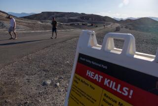
PRECAUTION: Extreme heat in summer.
FOR MORE INFORMATION: Death Valley National Park, Death Valley, CA 92328; tel. (619) 786-2331.
More to Read
Sign up for The Wild
We’ll help you find the best places to hike, bike and run, as well as the perfect silent spots for meditation and yoga.
You may occasionally receive promotional content from the Los Angeles Times.


