Dry Spell Could Be Rained Out
- Share via
It’s umbrella weather again in the Southland.
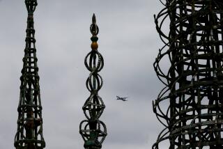
After a dry spell that has left Southern California with half its normal rain, a storm finally arrived Sunday and was expected to persist through Tuesday, with scattered thunderstorms predicted for today in Orange, Los Angeles and San Diego counties, plus desert areas.
And the precipitation is overdue, according to Jeff House, forecast meteorologist for WeatherData Inc. of Wichita, Kan., which provides weather information to The Times.
“You guys are way behind in rain for the season,” House said Sunday. “Hopefully, that rainfall deficit will get fixed with this storm. It has a chance of dumping a half-inch to an inch of rain in the valleys and the cities. Mountains might see two inches or more.”
Normally, he said, Orange County would have recorded 6.12 inches of rainfall by now in Santa Ana, the county seat. Instead, only 3.38 inches of rain had fallen by late Sunday.
The gap widens in L.A., where 7.1 inches of rain would be normal for the downtown Civic Center; only 2.03 inches of rain have fallen there, House reported.
Picture the storm that arrived late Sunday as a layered system moving south and east off the central California coast. The bottom layer is warmer; the top layer is cooler. House said the top layer is almost always cooler, but now it is much colder. And the dramatic temperature difference is what creates “unstable air that thunderstorms like,” House said.
Thunder will not linger long in any one spot, House predicted, and most areas will experience rain without the sound accompaniment.
Temperatures are expected to hover in the 50s and 60s today. The storm should move on by tonight, leaving dry but variably cloudy weather until a weaker, smaller storm arrives to drop a few showers Tuesday.
More to Read
Sign up for Essential California
The most important California stories and recommendations in your inbox every morning.
You may occasionally receive promotional content from the Los Angeles Times.


